This past Saturday, a few friends and myself decided to hike from the Luther Place trailhead up to the top of King Mountain and back. I helped reclaim this section of old Uwharrie Trail a few years ago, as the original Uwharrie Trail went that way and came out on Pisgah Covered Bridge Road. Since then, we’ve been able to get approval to move the Uwharrie Trail off the road for that section and into the Walkers Creek USFS area.
It was neat to see that the old white blazes had been painted over with yellow, indicating that this is now a side trail and not part of the main Uwharrie Trail anymore, since it now goes through USFS land up to near High Pine Church Road. The NC Zoo Society owns a tract of land on the road that will soon be part of the Uwharrie National Forest, and a new trailhead will open here called the Walkers Creek Trailhead.
But back to our Saturday hike. To park at the Luther Place Trailhead, you drive to approximately 8753 Pisgah Covered Bridge Road, according to Don Childrey’s book. That address is actually at a house, so the actual entrance is a little further east on Pisgah Covered Bridge Road. You will turn in and take a left fork to a USFS gate. There’s limited parking here, but if you turn around at the gate you can park several cars on the side of the gravel road.
You start out at that gate and walk the now yellow blazed trail. From here, the trail pretty quickly starts an ascent up to a ridgeline. You’ll climb pretty much straight up and then you will follow that ridgeline for a ways, and you’ll see where this trail hits the white blazed Uwharrie Trail. If you go right you’ll go up towards Walkers Creek, but if you go left, as we did, you’ll follow the old Uwharrie Trail to King Mountain. This route would eventually take you to the Joe Moffitt Trailhead on Thayer Road, but we didn’t go that far on Saturday.
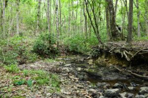
After you make that turn, you’ll continue for a ways to a sort of opening that looks like a road to the left, but you’ll just continue straight across. If you went left, you would run into Eagles Field road. You’ll cross a small stream, then start ascending again slightly before you come to a turn off to Camp 7 – one of Joe Moffitt’s Boy Scout camps. We didn’t go look at Camp 7 on the way up King Mountain but we did on the way back. It’s a side trail of less than half a mile in length one way, and comes to an old stone structure that has grates on either side where you could build a fire and cook.
There’s a sign on that old structure identifying the site as Camp 7, Twin Springs. There’s a list of the Boy Scouts that helped build the structure and a memorial to a friend. It also has the quote “Beware the doom of Eden – snake country.” There are certainly a lot of rattlesnakes known to be in this general area, but it was too cold this day to worry much about them.
From the Camp 7 turn off, you start climbing in elevation once again. You’ll go by an old hole in the ground where some previous landowners had done some gold prospecting. You’ll come to a four-way intersection and you stay to the right. Then you go a little ways and turn back to the left and then you start the short climb to the top of King Mountain. You need to be paying attention to see these two turns – there are some double blazing indicating the need to pay attention. When you get to the top, there’s a sign there indicating you’ve reached the peak, approximately 1020 feet in elevation. There were some nice views through the trees here and we stopped for a selfie by the sign. Then we turned around and started the trek back to our cars.
On the way back, near the old gold prospecting pit, we turned slightly off trail to the right and checked out a small flatrock area. There was a lot of moss there and some standing water on the rock. The remains of an old deer stand from when this was private land can be seen in a tree above. Three Rivers Land Trust purchased this property with loans several years ago, and then worked with the US Forest Service and the NC Wildlife Resources Commission to raise grant funds and transfer a part of the tract to USFS and a part to WRC.
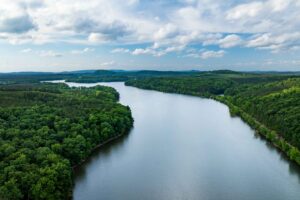
Altogether our hike was about 4 ½ miles and took about 2 hours. It was a good stretch to do after all this rain because there was only the one small creek crossing, and the trail was not muddy but mainly covered in leaf litter. Next time you’re looking for something to do on a sunny Saturday, consider the climb up King Mountain – the highest peak on the Uwharrie Trail. Now is a good time of year to do it while the leaves are off the trees and you can see the views.
You and a friend could also consider starting at Jumpin Off Rock and leaving a car at Luther place, that would be a 6.5 mile hike one way, if you don’t want to do any backtracking. Poison Fork might be a little high right now, but hopefully you can find a route to take across without getting your feet wet. On that stretch you’d climb both Little Long Mountain and King Mountain, both with great views this time of year. Hopefully we’ll have some more sunshine and warm weather for this time of year again soon.