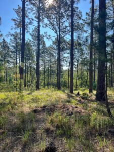
From the NC 109 parking lot, take the trail in the northeast corner. You will cross over two creeks in the....
Hike the Uwharrie Trail to Spencer Creek
Primary Route: Hike from the NC 109 Trailhead to Spencer Creek and back
Hiking Distance: ~4 miles round trip
Elevation Gain: 200 feet
Difficulty: Easy
Trailhead: NC 109 Trailhead.
Hiking Directions:
From the NC 109 parking lot, take the trail in the northeast corner. You will cross over two creeks int he first mile. At mile 1.6, you pass over a ridgetop at 660 feet of elevation. At mile 2.12, cross over the Spencer Creek bridge and turn left. This is a good area to have lunch. Take the same trail to the NC 109 parking area.